El Niño and La Niña: what each one is and how it changes Brazil's climate
They are two phases of the same Pacific cycle. One warms the water and the other cools it, and their effects on rain in Brazil are close to opposite.
Reviewed by Jackson on Nov 14, 2026. How we work
Quick answer
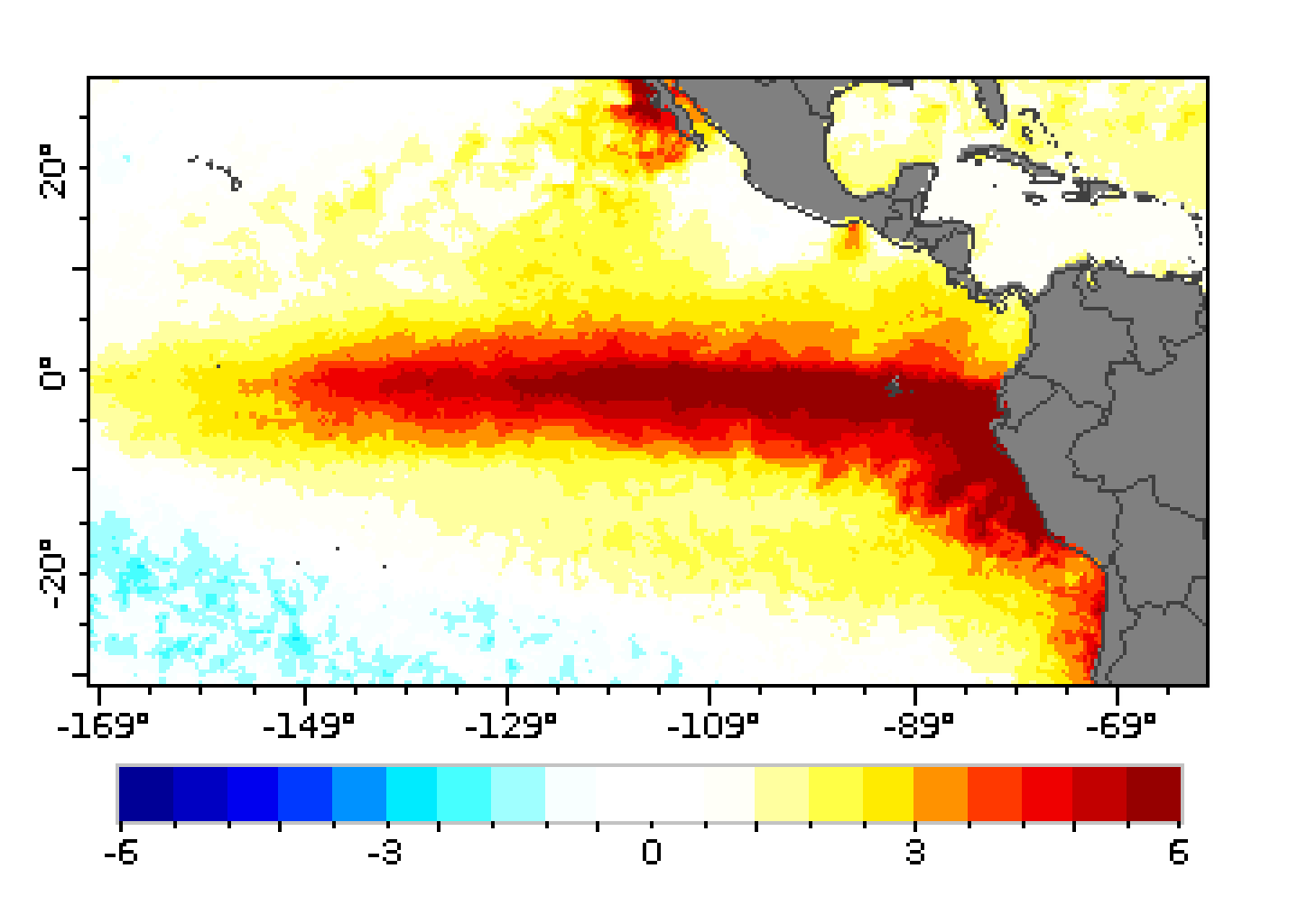
El Niño is an abnormal warming of the equatorial Pacific. La Niña is an abnormal cooling of the same waters. According to INMET, La Niña reduces rain in Brazil's South, while the North and Northeast tend to get more rain. With El Niño, the pattern largely reverses.[2][1]

In this article
Why it mattersTwo sides of one cycleEffects in BrazilWhat is happening nowWhat you can doWhat we don't know yetSourcesKey points
- El Niño is an abnormal warming of the equatorial Pacific, and La Niña is an abnormal cooling of the same waters.[2]
- A phase is only confirmed when the anomalies persist for about three consecutive months.[2]
- With La Niña, INMET points to less rain in the South and a tendency toward more rain in the North and Northeast.[2]
- The current El Niño, according to INMET, is expected to become very strong from November and favours above-normal rain in the South.[1]
Why it matters
Rain decides harvests, power generation and water supply. Knowing which phase the Pacific is in helps explain why a year is drier or wetter in certain regions.[2]
Two sides of one cycle
The Pacific Ocean changes temperature in cycles lasting years. When the water in the central and eastern equatorial Pacific warms above average, the phase is called El Niño. When it cools above normal, it is La Niña.[2]
These changes alter atmospheric circulation and, with it, the path of rain across much of the world.[2]
Effects in Brazil
With La Niña, the South tends to get less rain. The North and Northeast tend to get above-average rain, and temperatures can dip slightly in the Southeast and South.[2]
With El Niño, the pattern generally reverses: the South tends to get more rain, while the North and part of the Northeast tend to get less. For the current event, INMET expects above-normal temperatures across almost the whole country.[1]
These are typical patterns, not guarantees. Each event differs in strength and timing, so the effects can be weaker or stronger than the usual pattern in any given month.[2]
Rainfall is also shaped by local conditions, such as the state of the soil and the amount of rain already recorded, so two regions in the same phase can react differently.[2]
What is happening now
For November to January, INMET expects above-normal rain in the South and in parts of the Southeast and Centre-West, and below-normal rain across much of the North. More detail is in our article on the 2026 El Niño.[1][3]
Effects vary from region to region. Besides the phase of the Pacific, the temperature of the Atlantic can also weaken or strengthen the impact.[2]
INMET updates its forecasts monthly, so the regional picture can change from one bulletin to the next. Readers should compare the latest bulletin with the one cited here.[1]
What you can do
- Follow INMET's bulletins, which give the phase of the phenomenon and regional forecasts.[1]
What we don't know yet
- How long each phase will last, which depends on how the Pacific evolves.
- How strongly the phase will affect each city, which only becomes clear closer to the period.
Sources
- INMET: Painel El Niño: Boletim de outubro é divulgado (accessed Nov 14, 2026)
- INMET: Impactos do La Niña no clima brasileiro: o que esperar (accessed Nov 14, 2026)
- ZapTrend News: El Niño 2026: what the warnings say about rain, drought and heat at year-end (accessed Nov 14, 2026)